,
13 tweets,
7 min read
Read on Twitter
The Friends of Confederation Creek (FOCC) were very encouraged by our dealings with City Administration and their preliminary Confederation Park Stormwater Drainage Study report's findings. @ConfedCreek
calgary.ca/PDA/pd/Pages/C…
#yyc #yyccc
calgary.ca/PDA/pd/Pages/C…
#yyc #yyccc
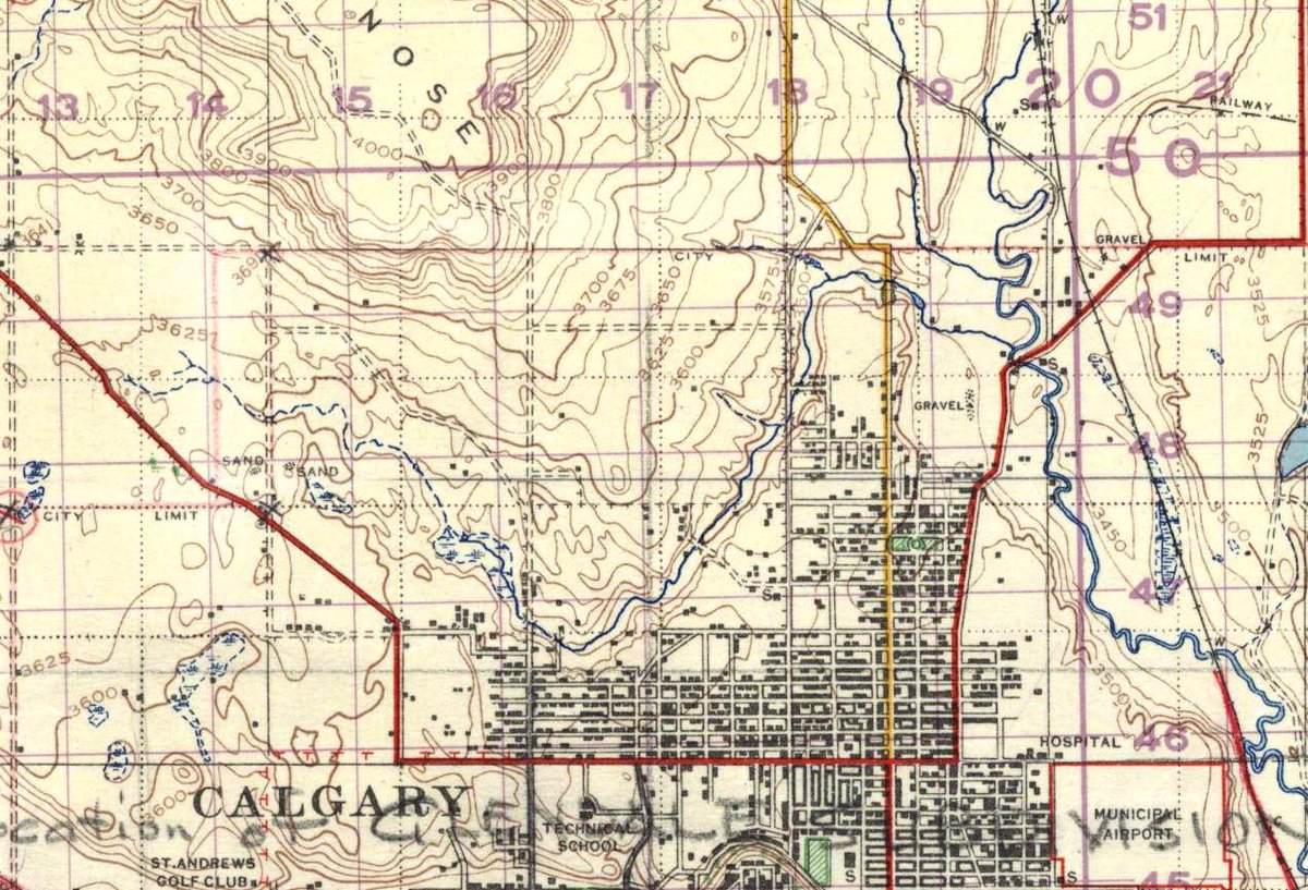
he North Hill Coulee was formed by the retreat of Ice Age glaciers and there has been water flowing in it since that time. This seminal AEP Report in 1961 clearly shows the Coulee (orange) & the legend the amount of groundwater present. (Map is from 1951.)
ags.aer.ca/publications/B…
ags.aer.ca/publications/B…
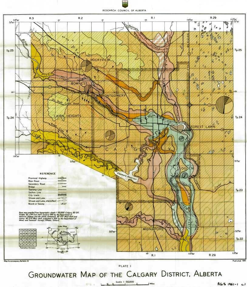
This is the largest water catchment in Calgary. It is 2700 hectares, encompassing communities from Shaganappi Trail to Edmonton Trail on the south side of Nose Hill; from Triwood and Varsity communities to Highland Park and Thorncliffe Greenview communities. Map from 1931.
By FOCC' s measurents 1,576,800 cubic meters of permanent water flow through this Coulee without the addition of storm water. This is Confederation Creek's base flow.
A generation ago, a group of citizens formed to create Confederation Park,(which includes Canmore Park, Confederation Park Golf Course)

These wise people recognised the amenity of the Creek and kept it daylighted in the Confederation Golf Course and Park. Most Calgarians know the Creek in Confederation Park which is Calgary's most popular park, and a #yyc historical resource: cambrianheightscommunity.com/community-news…
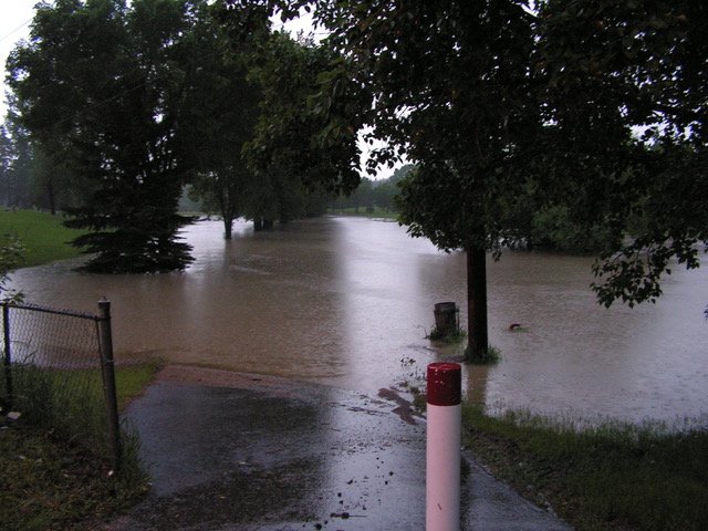
Because of the large amount of water from its catchment, Confederation Park floods regularly following rainfall.

The Creek goes into a vault at 30 Ave NW, but regularly escapes it in Queen's Park Cemetary with several manholes acknowledged to be problematic by @cityofcalgary.
Highland Park Valley is the bottleneck of the Creek that meets at least three other springs in the valley.
One creates a wetland in the Valley S. of McKnight Blvd that's reestablishing itself since the former golf course ceased operations. It's drained into @ConfedCreek
One creates a wetland in the Valley S. of McKnight Blvd that's reestablishing itself since the former golf course ceased operations. It's drained into @ConfedCreek
The McKnight Boulevard Creek and the Eggerts Park (also called Trafford) Creek are also vaulted, and add significant amounts to the vaulted Confederation Creek in the Highland Valley.

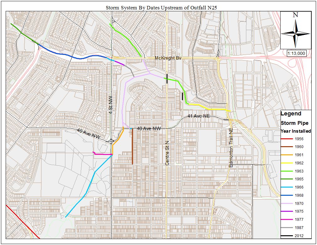
The FOCC's research shows at least 40 stormwater outfalls from surrounding communities developed from the 1950's to 1980's. This graphic of this small area was provided by @cityofcalgary


@threadreaderapp please unroll