,
19 tweets,
10 min read
Read on Twitter
The Great Alaska Earthquake occurred on March 27, 1964 and rocked the state with strong ground shaking that lasted four and a half minutes. #AlaskaEarthquake #earthquake
At M9.2, it was the 2nd largest quake ever recorded. This event also rocked the scientific community by confirming a major principle of #platetectonics with the observation that the oceanic Pacific Plate dives beneath the continental North American Plate at the Aleutian trench.
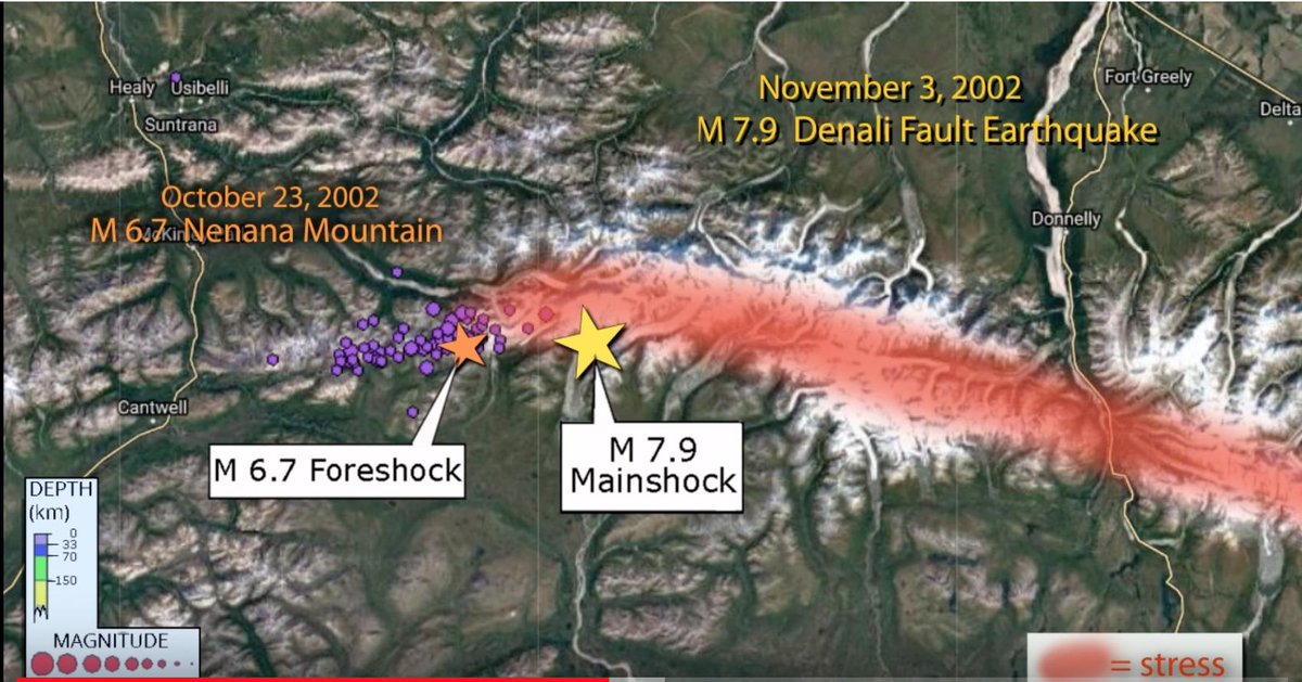
On average, #Alaska has 24,000+ measured earthquakes every year. Usually, there is at least one M7 every year. Between 1899 and 1986, eight #earthquakes of M8 or greater impacted different areas of the Aleutian subduction zone.
The energy released by earthquakes increases by a factor of ~30 for each unit increase in magnitude. As an analogy, if breaking 1 strand of pasta represents a M5 #earthquake, breaking 30 strands represents a M6, 900 is a M7, and 27,000 noodles is a M8. iris.edu/hq/inclass/les…
To represent the energy released in a M9 #earthquake we would need to break an immense bundle of 810,000 noodles! And the #Alaska 1964 earthquake was even larger at magnitude 9.2.
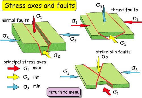
Let's examine the #platetectonics of the North Pacific region. The distribution of earthquake epicenters roughly defines plate boundaries. The Aleutian trench marks a 2100-mile-long subduction boundary between the Pacific and North American plates.
Along southeast Alaska and western British Columbia, the Pacific Plate moves against the North American Plate in strike-slip motion like it does along the San Andreas Fault in California. The rate of subduction varies from 2.2 - 3 in/year.
Most people think of an #earthquake as a sudden release of energy at the epicenter. In reality, an earthquake is caused by sudden displacement of rock across a fault at depth within the earth at the hypocenter.
The initial fault break in 1964 triggered a runaway rupture that displaced an area more than 500 miles long. The entire fault rupture elapsed over 4.5 minutes releasing immense seismic energy equivalent to a cascade of 1,000 M7 earthquakes.
The oceanic plate dives beneath the continental plate at ~2.5 in/yr. Because tectonic plates are elastic like a spring, converging plates build energy. Locked by friction, the upper plate is forced back & shortened, raising the land surface. #GPS is able to measure that strain.
In 1964, the force of the converging plates overcame friction, and caused the leading edge to lurch seaward, uplifting the seafloor, forming a mound of seawater that spread out as a #tsunami. As coastal areas near the trench were uplifted, areas inland dropped.
During the 1964 #earthquake, the area at the leading edge of the plate rose up as high as 9m as the landward region subsided up to 2m, raising the shoreline barnacles above sea level & dropping the inland shoreline below sea level killing trees, leaving ghost forests.
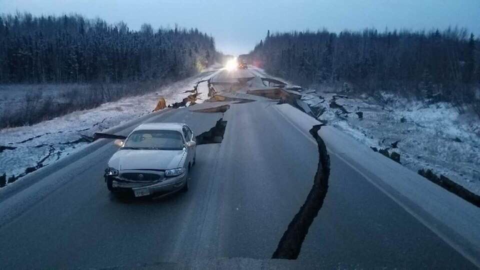
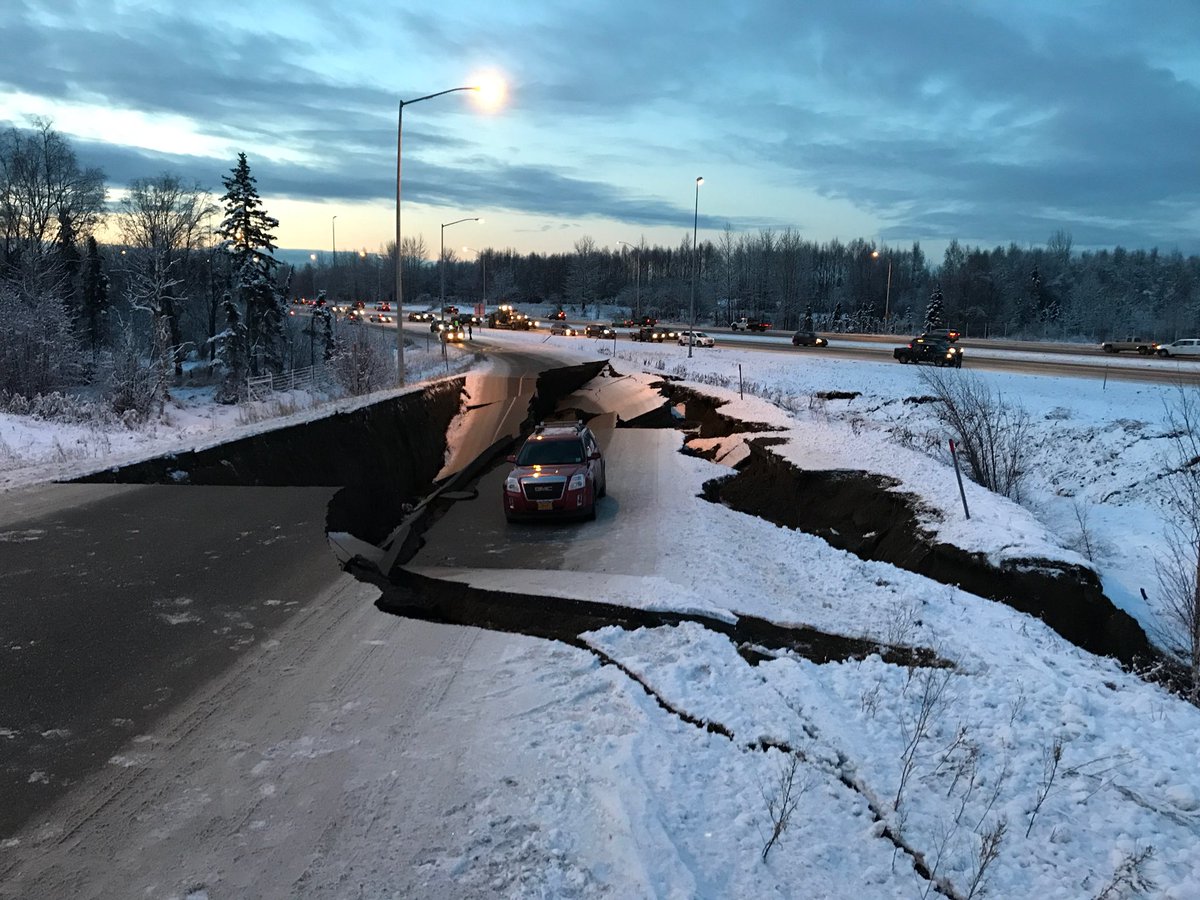
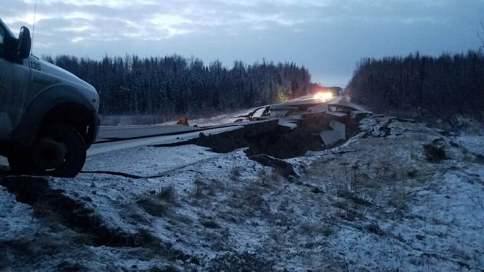
The ground shook relentlessly as the rupture progressed along the fault surface. Prolonged shaking served to liquefy underground water-saturated sediment. Liquefaction triggered the landslides that caused in major damage in Anchorage.
Measurements of land and seafloor deformation taken by USGS geologist George Plafker & co-workers soon after the #earthquake, led them to propose that under-thrusting of the Pacific Plate beneath Alaska caused the earthquake.
This discovery helped establish subduction of oceanic plates beneath continental plates, and megathrust earthquakes as fundamental processes of plate tectonics
Since 1964, when there were only two seismometers in #Alaska, monitoring earthquakes and ground deformation to assess hazards and to mitigate future risk has greatly increased. usarray.org/alaska
Research that characterizes earthquakes and faults serves to reduce the possibility of casualties by better land-use planning and constructing earthquake resistant buildings, allowing us to live more safely in #earthquake zones.
@threadreaderapp unroll