Official Twitter account for the National Weather Service New Orleans. Details: https://t.co/iCJUV7vGsN
How to get URL link on X (Twitter) App


 Baton Rouge broke its warmest summer on record by an almost unfathomable 2.8 degrees! Records go back to 1892.


 We want to continue to stress that this WILL be a DANGEROUS and LIFE-THREATENING storm. There WILL be significant wind damage. Prepare for widespread power outages and tree/structural damage in these purple/red areas on the graphic below.

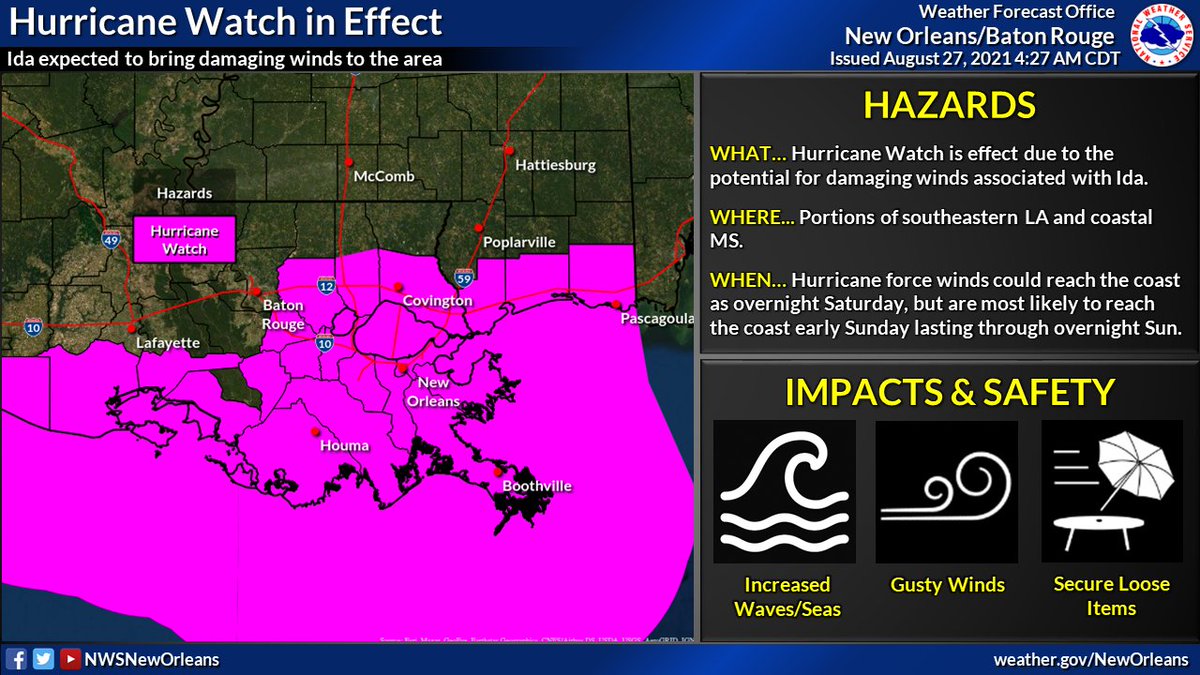
 🍃 A Hurricane Watch is in effect for portions of southeastern LA, coastal MS and adjacent marine areas. Damaging winds will be possible beginning overnight Saturday along the coast, spreading inland into Sunday. #lawx #mswx (2/5)


 💆 DO NOT PANIC! Be prepared, stay up to date, and try to remain calm. You have time IF you begin today. If the track continues as forecast, conditions will likely begin to go downhill late Saturday. This gives you today, Friday, & even early Saturday. #LAwx #MSwx

 1. 💨 Wind: Strong winds will be the primary threat when #Zeta makes landfall. These winds may lead to isolated to scattered power outages, some tree damage and even some damage to some structures - especially near the center of the track. (2/6) #lawx #mswx
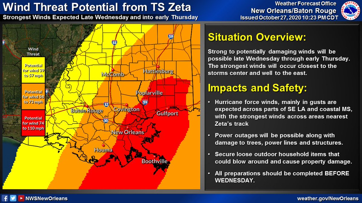


 (2/6) Hurricane and Tropical Storm Watches remain in effect for a large portion of SE LA and coastal MS. Strong, potentially damaging winds may be possible in association with #Zeta late Wednesday through early Thursday. #lawx #mswx


 💨(2/5): No changes to the Tropical Storm Watches and Warnings that remain in effect. Expect winds to increase across coastal areas of SE LA later today/tonight, and spread inland during the day on Friday. #lawx #mswx


 Locally, the strongest winds from #Delta are expected across areas nearest the Atchafalaya River.

 Locally, the strongest winds from #Delta are expected across areas nearest the Atchafalaya River.

 🌀 (2/6) Tropical Storm and Hurricane Watches are now in effect for portions of SE LA and S MS. Expect gusty winds to increase across the area late Thursday and into Friday - lasting into early Saturday. #lawx #mswx


 🌀 (2/3) As a reminder, NOW is the time to have a plan! Don't let the recent cool temperatures fool you - it is still Hurricane Season! Impacts remain likely with this system across portions of the northern Gulf coast and you should take it seriously! #lawx #mswx


 🌊 Life-threatening storm surge flooding is possible across coastal portions of SE LA generally west of Grand Isle.
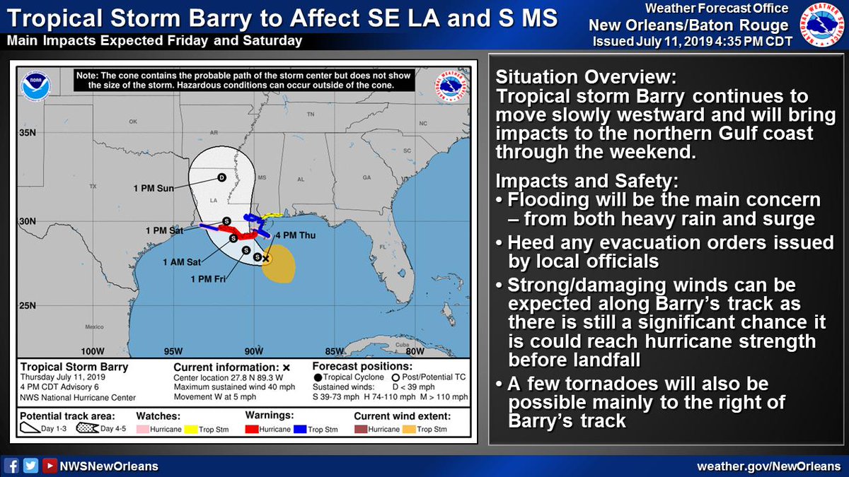
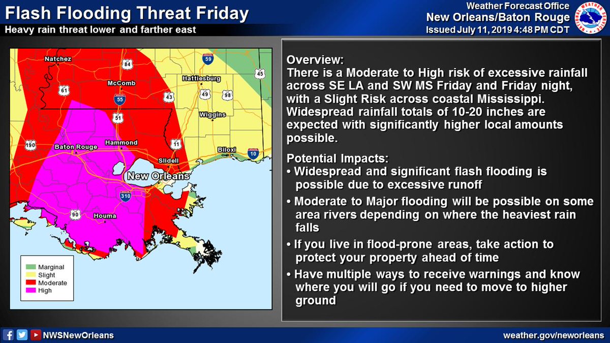
 (2/6) Significant flood threat associated w/ #Barry