Discover and read the best of Twitter Threads about #PalOpenMaps
Most recents (3)

Next Monday (15 May) will mark 75 years since the Nakba, when over 500 Palestinian communities were forcibly depopulated during the creation of the Israeli state. To mark the occasion, we have re-launched #PalOpenMaps with a bunch of new features
palopenmaps.org/en/
1/6
palopenmaps.org/en/
1/6
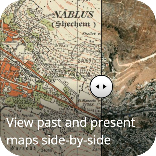
Palestine Open Maps #PalOpenMaps allows users to search, navigate and download over 330 highly detailed maps of #Palestine before the Nakba, and also to compare past and present geographies
2/6
2/6


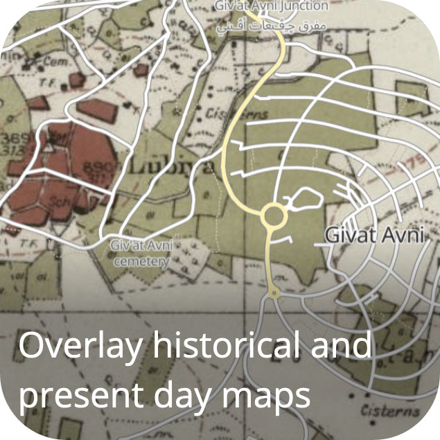
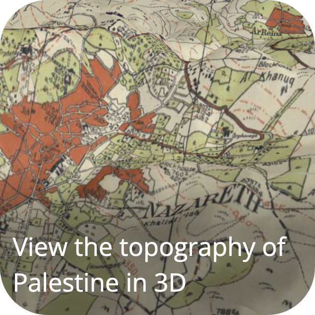
The new version of #PalOpenMaps has added:
- Arabic language
- 1940s aerial photography layer
- Crowd sourced historical map overlay
- Links to local information on other sites
- 3D view
3/6
- Arabic language
- 1940s aerial photography layer
- Crowd sourced historical map overlay
- Links to local information on other sites
- 3D view
3/6

1/ A year ago, @visualizingpal launched #PalestineToday, telling the story of 1,200 historical towns, villages and cities, and highlighting how the #Nakba and the foundation of #Israel in 1948 created the fractured #Palestinian geography that we see today today.visualizingpalestine.org
2/ Looking at the history of the region in this way helps us to put today's events in context. Eg. in "mixed cities" like #Jaffa, #Haifa or #Lydd, where many #Palestinians were forcibly displaced in 1948, and those that remained became an isolated minority today.visualizingpalestine.org/lydda/
3/ In the #GazaStrip, where nearly 70% of the population are refugees originating from towns and villages in what became #Israel, the population of towns and cities like #Gaza, #Rafah and #KhanYounis have increased massively today.visualizingpalestine.org/rafah/
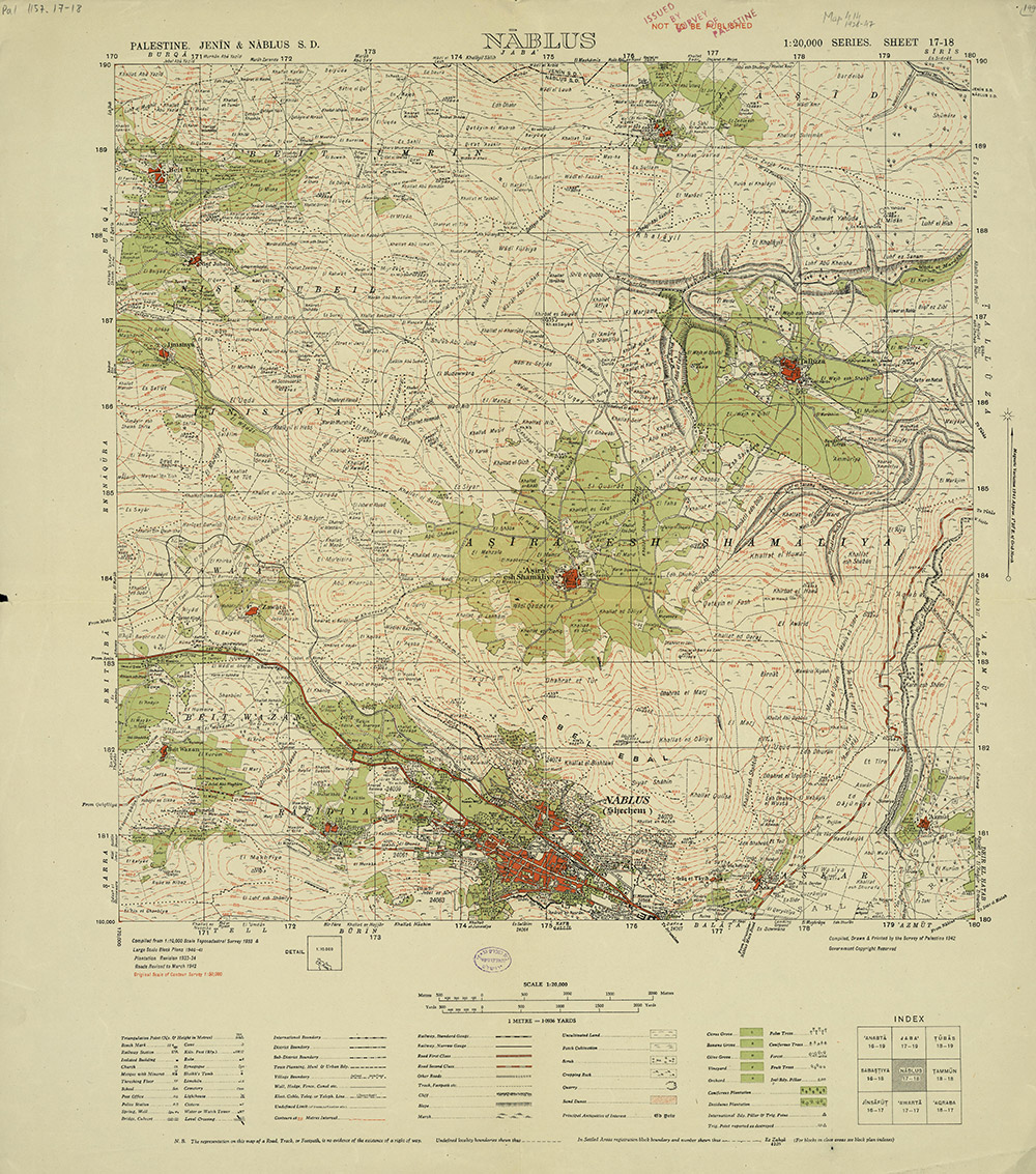
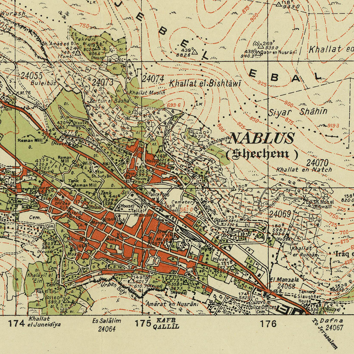
1/ Hello world! We just made 338 #HistoricMaps of #Palestine available to download in high resolution on Palestine Open Maps #PalOpenMaps. Please do share! palopenmaps.org (a project supported by @visualizingpal @basselkhartabil @creativecommons @mozilla @fabricatorz)
2/ All of the maps are in the public domain (expired copyright), sourced from archives including the David Rumsey map collection, the Israeli and Australian national libraries. The maps are all scanned at resolutions of at least 300dpi. Here's an example of the detail level...
3/ We also just added a new split-screen mode to #PalOpenMaps, so that you can instantly compare the various historic map layers to present day satellite maps and #OpenStreetMap road overlays palopenmaps.org
