
Map and Investigations = https://t.co/fKEp7FqbhI
Managed by volunteers.
Data shared with @Cen4InfoRes and @Bellingcat
You can help us: https://t.co/9JWTu6EMRr


 29 subscribed
29 subscribed
29 subscribed
 22 January 2024.

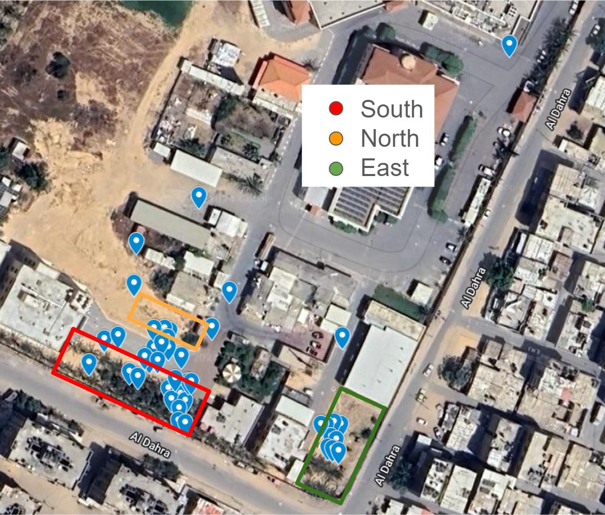
 25 JAN 2024 - Palestinian burials by Palestinian people in Nasser Hospital. (VID 01)
25 JAN 2024 - Palestinian burials by Palestinian people in Nasser Hospital. (VID 01)
25 JAN 2024 - Palestinian burials by Palestinian people in Nasser Hospital. (VID 01)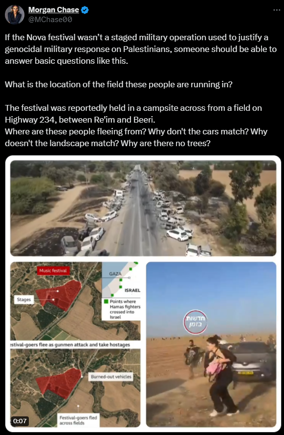 Firstly, we searched for the original videos in our database. We will list them below along with the source. The videos are named "Drone vid" and "Vid 01"
 Source of the disinformation:
 Source of the disinformation:
 Related:
 Due to @Partisangirl's spread of disinformation, we are obligated to respond with the information we have gathered during our ongoing investigation into the terrorist attacks on October 7th.


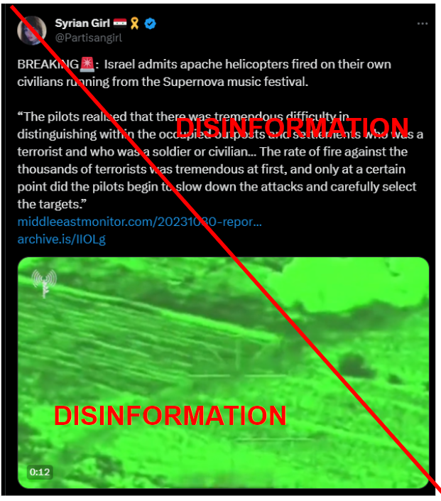
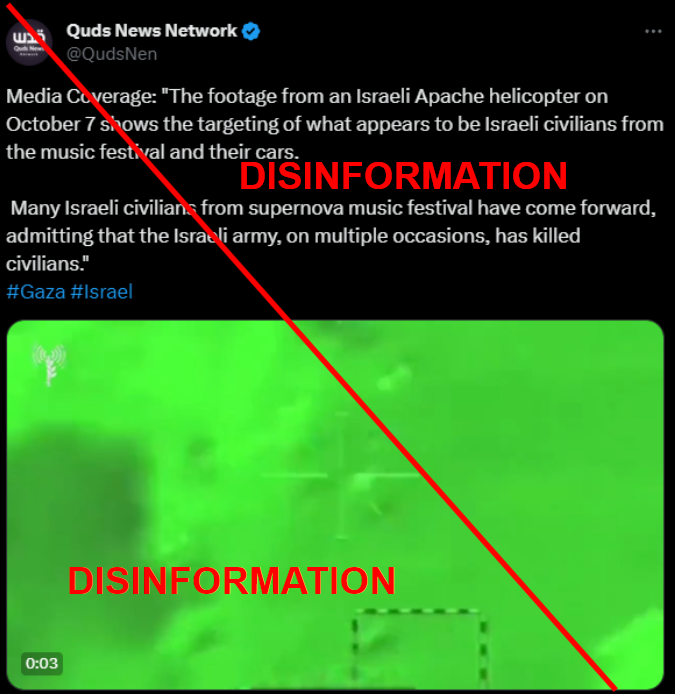 It got a lot of attention after it was spread by @Partisangirl.
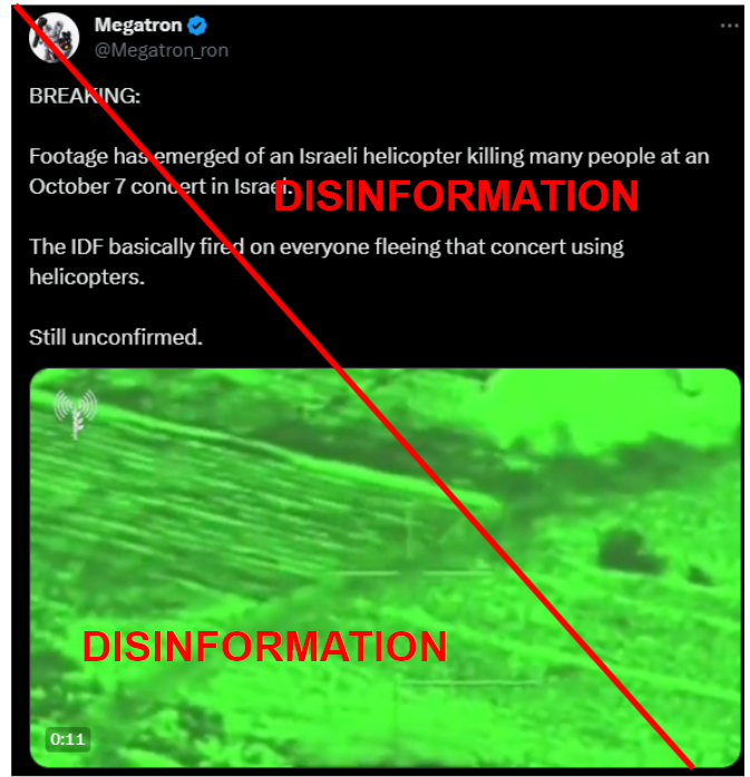
 Losses older than 9 October (Purple).
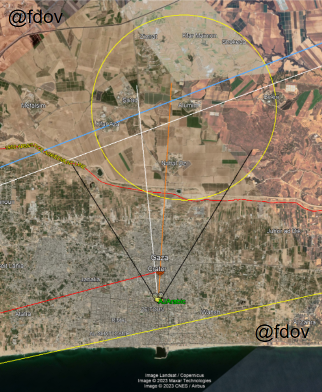 Based on the investigations conducted by @fdov21 , @OAlexanderDK and @ArchieIrving2 regarding the Al-Ahli Baptist Hospital explosion.

 @moklasen @Tatarigami_UA @DefMon3 Here you see armored vehicles (82nd Air Assault Brigade) crossing the trench system.