Discover and read the best of Twitter Threads about #geographic
Most recents (6)

Machine Learning (ML) algorithms have revolutionized spatial analysis, providing new insights into geographic data. Here's a list of popular ML algorithms used in #geospatial #DataScience
#DataScience #MachineLearning #SpatialAnalysis #gischat
#DataScience #MachineLearning #SpatialAnalysis #gischat
K-means clustering is a popular unsupervised ML algorithm used for clustering and segmentation of spatial data. It's used to identify spatial patterns, group similar geographic features, and create thematic maps.
Random Forests is a supervised ML algorithm used for classification and regression tasks in Geospatial Data Science. It's used to predict land use, soil properties, and other geographic variables.

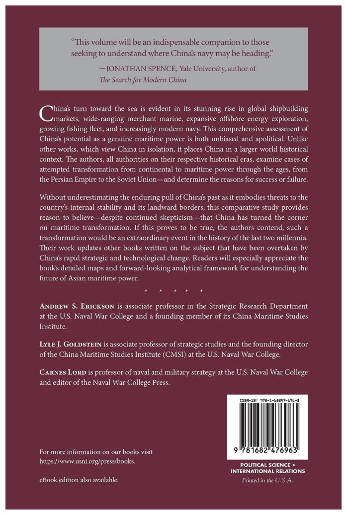
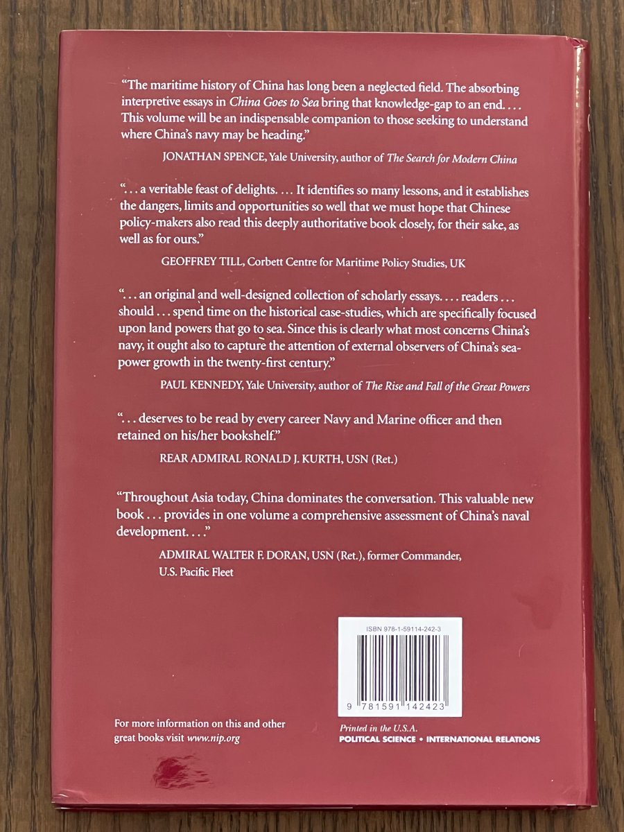
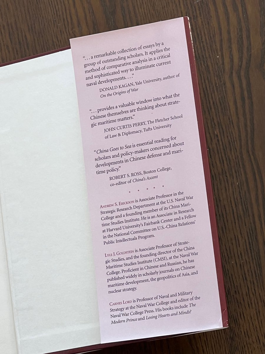
Now Out in Paperback! “#China Goes to #Sea: #Maritime Transformation in Comparative Historical Perspective”
amazon.com/China-Goes-Sea…
@NavalWarCollege @ChinaMaritime is proud to publish this new version w/ @NavalInstitute @USNIBooks!
Come for the #maps, stay for the #history...
amazon.com/China-Goes-Sea…
@NavalWarCollege @ChinaMaritime is proud to publish this new version w/ @NavalInstitute @USNIBooks!
Come for the #maps, stay for the #history...
Honored to have #JonathanSpence’s endorsement:
“The maritime #history of #China has long been a neglected field..China Goes to Sea bring[s] that knowledge-gap to an end..will be an indispensable companion to those readers seeking to understand where China’s navy may be heading.”
“The maritime #history of #China has long been a neglected field..China Goes to Sea bring[s] that knowledge-gap to an end..will be an indispensable companion to those readers seeking to understand where China’s navy may be heading.”


Is #concentration rising? @AffeldtPauline, @JoannaPiechucka, #KlausGugler and I use a novel dataset containing information on over 20,000 relevant antitrust markets between 1990-2014 to assess this question: cepr.org/active/publica…. We find quite some heterogeneity. A thread 1/N

The extant literature measures #concentration using #industry classifications. Data are mostly aggregated at the national/regional level for all products. Yet, both the #geographic and the #product market definitions should be based on the #substitutability among products. 2/N
Our database identifies over 20,000 product/geographic #antitrust markets affected by over 2,000 mergers scrutinized by the European Commission between 1995-2014. This allows measuring concentration consistently on an economy-wide basis over time (diw.de/documents/publ…) 3/N


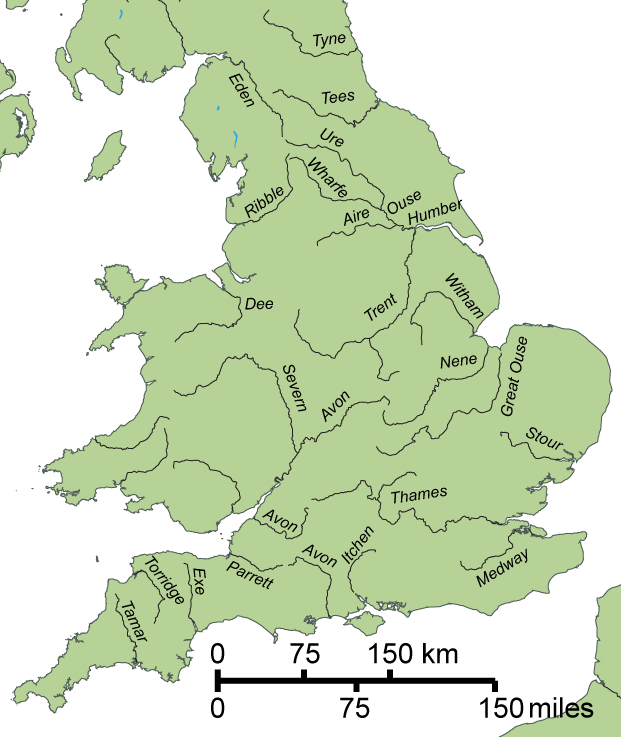
#Hydronomastics is the study of #hydronyms, the proper names of bodies of water.
It's a branch of #toponomastics, the study of #toponyms (the proper names of places), which in turn is a branch of #onomastics, the study of #orthonyms (proper names).
French / Luxembourghish sign:
It's a branch of #toponomastics, the study of #toponyms (the proper names of places), which in turn is a branch of #onomastics, the study of #orthonyms (proper names).
French / Luxembourghish sign:
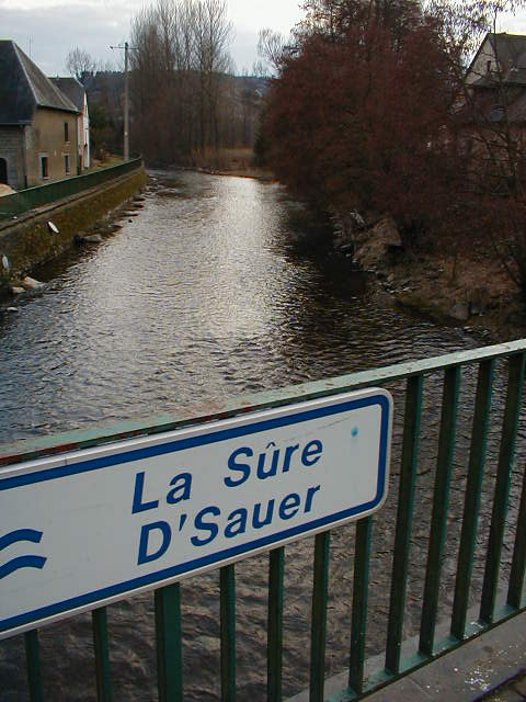
#Hydronym and #hydronomastics both derive from Ancient #Greek ὕδωρ / húdōr (water) + ὄνομα / ónoma (name).

#Hydronyms tend to outlast other #toponyms, even when new #languages and cultures displace earlier ones.
#England, #EastAnglia, #Essex, and #Sussex are named for the #Angles and #Saxons; but #Trent, #Ouse, #Thames, #Severn, and #Avon are older #Celtic and #RomanoBritish names.
#England, #EastAnglia, #Essex, and #Sussex are named for the #Angles and #Saxons; but #Trent, #Ouse, #Thames, #Severn, and #Avon are older #Celtic and #RomanoBritish names.

1/ #China’s #Maritime Forces push hard in #SouthChinaSea despite – or because of – #coronavirus #pandemic.
–@inquirerdotnet
>bit.ly/2RrK639
>bit.ly/2xbP3WZ
—
#natsec #strategy
–@inquirerdotnet
>bit.ly/2RrK639
>bit.ly/2xbP3WZ
—
#natsec #strategy

2/ #China unleashes #maritime power to press #EastAsia & #IndoPacific hegemony while #USNavy and US & other governments deal w/#coronavirus #pandemic:
–@RadioFreeAsia
>bit.ly/2RrwuEM
–@ShaolinTom/@Newsweek
>bit.ly/3aZZ5Jp
—
#nationalsecurity #natsec #strategy
–@RadioFreeAsia
>bit.ly/2RrwuEM
–@ShaolinTom/@Newsweek
>bit.ly/3aZZ5Jp
—
#nationalsecurity #natsec #strategy
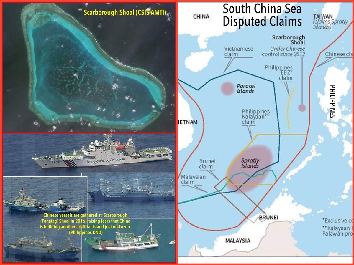
3/ #China combines #softpower w/ #maritime power in unrelenting pursuit of its international realignment goals even as – or because of – #coronavirus #pandemic rages through #SEAsia:
–@SBengali/@latimes
>lat.ms/2y3z8Kc
—
#nationalsecurity #natsec #strategy #IndoPacific
–@SBengali/@latimes
>lat.ms/2y3z8Kc
—
#nationalsecurity #natsec #strategy #IndoPacific

Around 3000 BCE in eastern #Europe, a Proto-Balto-Slavic #language started to diverge from #ProtoIndoEuropean.
The #Slavic branch of the #IndoEuropean #languages began about 2,000 years later when Proto-Slavic deviated from Proto-Balto-Slavic.
[Image: commons.wikimedia.org/wiki/File:Balt…]
The #Slavic branch of the #IndoEuropean #languages began about 2,000 years later when Proto-Slavic deviated from Proto-Balto-Slavic.
[Image: commons.wikimedia.org/wiki/File:Balt…]
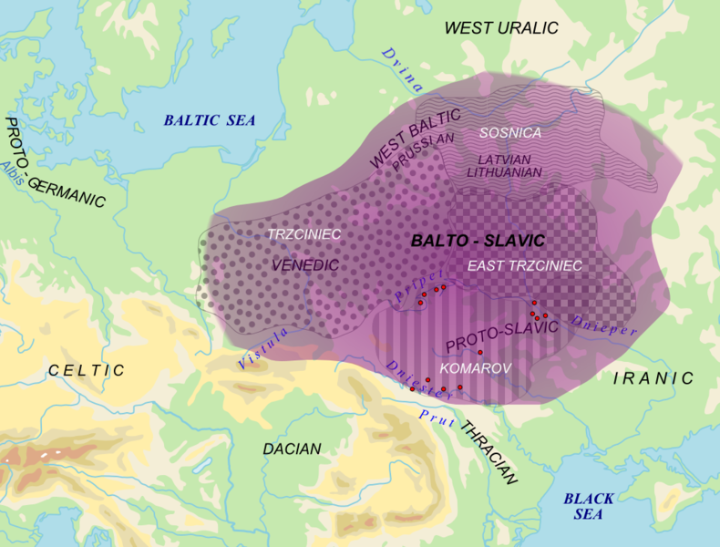
As the #Slavic-speaking area expanded during the first millennium CE (striped area on map), Proto-Slavic transitioned to Common Slavic. The #language underwent minor changes that occurred mostly uniformly across eastern #Europe, thereby maintaining mutual intelligibility.

Around the year 1000 CE #CommonSlavic began to split into the South, West, and East branches to which all modern #Slavic #languages belong.
Roughly 315m people speak a Slavic #language, mostly in Eastern #Europe (including the #Balkan peninsula), #CentralAsia, and #Siberia.
Roughly 315m people speak a Slavic #language, mostly in Eastern #Europe (including the #Balkan peninsula), #CentralAsia, and #Siberia.

